I’m often hesitant to plan Sunday hikes that start on the eastern side of the Sierra. Traffic home can be a real bitch, with all the weekenders returning from the Tahoe area. But September and October are quiet for Tahoe recreation so I chanced being caught in a 10-mile traffic jam on 50 in the afternoon. (I got lucky.) I also avoid the Tahoe area because the trails can be a little too accessible and crowded. Again, though, knowing we are between busy seasons, I gave it a go.
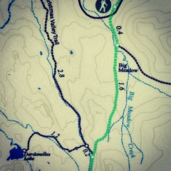
The (Big Meadow) trailhead parking is easy to find off of Highway 89. There is no use fee and the mapless hiker can snap a photo of the trail map at the start.


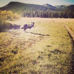
The way to Dardanelles Lake starts on the Tahoe Rim Trail. It crosses Hwy 89, and after a short incline, enters the very large Big Meadow. Next, the trail climbs up and over a ridge (the toughest part of this hike, but not terribly strenuous), to a trail junction at mile two. There, hikers take a right, and then 0.2 miles later, at an unsigned trail junction, make a left to Dardanelles Lake. After 1.2 miles, the trail ends at a string of campsites along Dardanelles Lake.
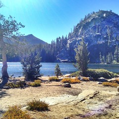
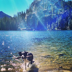
The lake is clear and cold with sloping granite “beaches.” Perhaps the most striking feature is the granite monolith that dominates one end of the lake. The setting is pretty as a painting.
This was my first experience with the Tahoe Rim Trail. As it’s name suggests, the TRT is a loop around Lake Tahoe. It is 165 miles long, but I only hiked 2 miles of it before turning off to head towards Dardanelles Lake. I’m intrigued, though . . . so stand by for more TRT adventures after this one!
Source: Stienstra, Tom and Brown, Ann Marie. "Dardanelles Lake." California Hiking. 3rd ed. San Francisco: Foghorn Press, 1997. Print.
Length: 7.6 miles according to the book, 6.8 miles according to the map at the trailhead, and 9.5 miles according to @sidecar_tony on Instagram. (It felt like 6.8 miles to me.)
Water: The smallest tributaries are dry, but the lake and larger streams still have plenty of water.
Use: Moderate to heavy.
Differences from published description: Some discrepancy on just how long the trail is.
Jasper’s rating: 4.5 paws out of 5. (Jasper knocked this down half a paw because there weren’t enough sweeping views.)
Sporty Sunday is a recurring feature in which I share my fitness routine and offer and solicit advice. While this content might seem a little out of place in an outfit diary, a healthy, strong body is the foundation of my wardrobe. I hope to inspire my readers to be fit as well as stylish!
No comments:
Post a Comment
You can comment anonymously - but please at least give us a pseudonym so we can tell the anons apart!
Spam and sexual or just plain mean comments will not be published. Don't cry "censorship;" start your own blog.